


Voting District 50191, Orange County, California
About
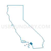
Outline

Summary
| Unique Area Identifier | 536551 |
| Name | Voting District 50191 |
| County | Orange County |
| State | California |
| Area (square miles) | 3.36 |
| Land Area (square miles) | 3.26 |
| Water Area (square miles) | 0.10 |
| % of Land Area | 97.07 |
| % of Water Area | 2.93 |
| Latitude of the Internal Point | 33.51402480 |
| Longtitude of the Internal Point | -117.65043040 |
Maps


Graphs
Select a template below for downloading or customizing gragh for Voting District 50191, Orange County, California


Neighbors
Neighoring Voting District (by Name) Neighboring Voting District on the Map
- Voting District 50091, Orange County, CA
- Voting District 50156, Orange County, CA
- Voting District 50176, Orange County, CA
- Voting District 50181, Orange County, CA
- Voting District 50186, Orange County, CA
- Voting District 50196, Orange County, CA
- Voting District 50201, Orange County, CA
- Voting District 50206, Orange County, CA
- Voting District 50231, Orange County, CA
- Voting District 50236, Orange County, CA
- Voting District 50256, Orange County, CA
- Voting District 50596, Orange County, CA
Top 10 Neighboring County Subdivision (by Population) Neighboring County Subdivision on the Map
Top 10 Neighboring Place (by Population) Neighboring Place on the Map
Top 10 Neighboring Unified School District (by Population) Neighboring Unified School District on the Map
Top 10 Neighboring State Legislative District Lower Chamber (by Population) Neighboring State Legislative District Lower Chamber on the Map
Top 10 Neighboring State Legislative District Upper Chamber (by Population) Neighboring State Legislative District Upper Chamber on the Map
Top 10 Neighboring 111th Congressional District (by Population) Neighboring 111th Congressional District on the Map
- Congressional District 44, CA (844,756)
- Congressional District 48, CA (727,833)
- Congressional District 42, CA (667,638)
Top 10 Neighboring Census Tract (by Population) Neighboring Census Tract on the Map
- Census Tract 320.23, Orange County, CA (13,544)
- Census Tract 423.12, Orange County, CA (9,085)
- Census Tract 422.03, Orange County, CA (7,015)
- Census Tract 320.22, Orange County, CA (6,833)
- Census Tract 423.15, Orange County, CA (5,900)
- Census Tract 320.61, Orange County, CA (3,349)